A Hanwell walk 8 – from Boston Manor tube down to Brentford

Where exactly am I?

Strictly speaking this is a Brentford walk, not a Hanwell one. For some reason I’ve always thought Hanwell extends down as far as Swyncombe Avenue, or maybe even The Ride. As I got ready to start this second part of my Hanwell stroll down Boston Manor Road, the new infographic just outside Boston Manor station caught my eye. There, at the top, it boldly stated ‘BRENTFORD’. So Boston Manor station isn’t in Hanwell; it’s in the top-left corner of Brentford. I’ve lived just up the road in Hanwell for just shy of 20 years and I didn’t know that.

The new infographic sign.

Well, wherever it is, Boston Manor station sits on top of the bridge where the Boston Manor Road rises to cross the Piccadilly line, then dips again. To the left, or northwest, the road bends on up towards Hanwell Broadway.

Boston Manor Road looking north-west.

About 120 years ago it looked like this – a country lane with grass verges under hedge, fence, trees and fields. Must have been some upheaval when that was all built on in the 1930s.*

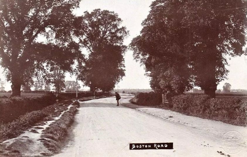
The same view 120 years ago. Not sure what that bloke is up to.

Boston Manor station reminds me a bit of Thunderbirds’ Tracy Island HQ, well perhaps at night, with an unreliable memory. A glimpse of the imagined future we felt as children but that never came to pass.

Ghostly neon glow – this flight tonight.

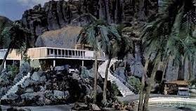
The ‘real’ Tracy Island – memories are uncertain friends.

Ahead, under the station bridge, the Piccadilly line skirts the sheaf of track lines, spaghetti fronds that lead to the long shed of Northfields depot. The new infographic just outside the station shows the pattern of the tracks in all its glory. Behind me, inside the station and down the steps, it coaxes and co-axes between straight platforms.

The tracks splay to the depot shed.

View from the bridge.

Left hand side down to Swyncombe Avenue

All that metal and power gave me an imagined sensation that the electromagnetic goings-on around the Piccadilly line had grabbed me and were pinging me slowly down the road in Supermarionation, like a character from Thunderbirds. So off I bounced towards the heart of Brentford to the south-east.

Looking down Boston Manor Road from the station.

The road is wider here than up towards Hanwell town centre. To the left it is bordered by a broad pavement and occasional tree, while on the right it comprises a cycle lane and sunken paved footpath, separated by a grassy central reservation with plane trees at regular intervals. There’s none of the dense, crowded jumble of shops and house types you find north of Boston Manor station, and the neat thirties houses seem bigger, their front gardens longer. As if the road down here were a kind of runway, girding its loins in anticipation of a take-off on the Great West Road towards Heathrow.

Indeed, the speed limit here is greater too, a good old-fashioned 30 mph, which adds to that sense of being propelled, even when on foot. I’m not sure, but the different speed limits could be a boundary thing between the boroughs of Ealing and Hounslow. It will only be a matter of time before it gets reduced to 20 mph, I’m sure.

313 mystery.

No sooner was I over the bridge opposite the tube station than I encountered what appeared to be a modest office building, now empty. It has a brief name: ‘313’. What sort of office was it with no signage? Multi-company? Secret? What old office party tales would the walls tell? The truth about the great Luncheon Vouchers scandal of 2002? It’s up for sale and you can find out more here.

Perhaps it will be knocked down and replaced by what the brochure describes as ‘micro apartments’, yet more residential building, only more compact. It seems unlikely, perched as it is between the road and the bridge.

Gates to the depot?

Behind the building is a metal gate and a barrier that I guess protect Northfields train depot. I took a photo and would have gone closer but for the sudden appearance of a hi-vis jacket chap.

I moved on. The long row of 1930s terraced houses on the left was occasionally punctuated by side alleys I didn’t dare slip down… too shy to find out whether they connect along the back.

The houses down this side of the road all look the same… but it does feel like being on a road to somewhere, not just in somewhere. For until you reach the mini roundabout at Swyncombe Avenue, there are no turnings off on the left, apart from the path to Blondin Park behind black iron gates, the left gatepost of which leans endearingly these days.

Blondin Park sign.

An information sign shows a map of the park and the Northfields depot track array (again), and the path takes you past allotments, a nature reserve and the park beyond, dominated by the long shed of Northfields depot, and extending all the way over to Northfields.

Cool banner.

The park hosts the Brentford Festival on the first Saturday each September. Unfortunately we’re always away at that time, though one year we did make it back in time to see a cool band, sup a welcome pint and soak up the last of the summer rain.

The left-hand side concludes with a short stretch of older terraced houses, perhaps Victorian, and the mini roundabout at the top of Swyncombe Avenue. It may only be mini but it’s always busy, for it’s a rat run to Northfields.

Right hand side down to Swyncombe Avenue

Back up at Boston Manor station I started down the road again, this time on the right hand side. I peered through the pale blue-grey fencing down at the criss-cross of tube tracks as they disappeared under the bridge in the direction of Northfields.

View from the other side of the bridge.

Bridge House and Bridge House South straddle Boston Gardens, the first of the side roads back up near the tube station. These three-storey art deco-ish blocks of flats are slightly chipped and frayed at the edges, though I’m told they are lovely inside. Large arched windows pour light into spacious stairwells.
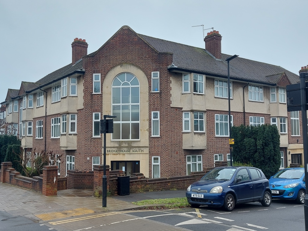
Bridge House South.

If you nip down Boston Gardens a short distance, you get a side view of the station platforms.

View from the side.

Heading down from Boston Manor station I noticed that the houses on the right look the same as those on opposite side of the road, in terraces of six or so residences, complete with the occasional house whose turn it was to undergo treatment under scaffolding and plastic sheeting. The procession of terraced facades resumed, all the way down to the start of Boston Manor Park opposite Swyncombe Avenue.

Back alleys of Boston Gardens.

But these facades do hide a surprise of sorts. A series of untarmacked side alleys and short grassy passages lead to narrow back lanes behind back gardens, forming a kind of ladder of residences. A hidden garage land that smells of foxes. A tidy, private world of extensions, loft conversions, the odd shopping trolley lying on its side next to a short row of wheelie bins… but no litter, no broken glass. Just class.

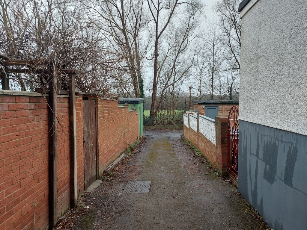
Back alley with playing field beyond.

Boston Gardens’ back gardens overlook Boston Manor Playing Fields, maintained and operated by the London Playing Fields Association. It comprises a 22-acre sports field with a lot of pitches for cricket, football and rugby. There’s also a running track, a keeper’s house and mini grandstand. This is where pupils from Gunnersbury Catholic School down the road enjoy, or perhaps endure, their sport. Beyond, the Chiswick Flyover and the canal soar and flow respectively.

Back on the main road I loitered at the entrance to the jewel in the crown that is Boston Manor Park. On the day I did this part of the walk it started tipping down. I gazed at the grey rainswept lake and conjured in my mind that haunting scene in the 1960s film, The Innocents, where Miss Giddens sees the ghost of Miss Jessel. (Boston Manor Park and the newly reopened manor house will feature in a future walk/blog.)

Searching for a ghost in a long black dress.

I followed the long six-foot-plus high brick wall, all 300 yards of it, on down the road. Pretty soon I came upon a milestone set in the wall, though I was unable to read the inscription.

It’s no good. My eyes aren’t what they used to be.

The main entrance gate was politely imposing with its giant wrought iron gates. The wall on each side is much higher as it curves into the drive and the grey brickwork is replaced by clean red bricks interspersed with black ones to form a geometric pattern.

Boston Manor Park main gate with the lodge beyond.

Further down, was the second, lesser set of entrance gates, and another milestone set in the wall.

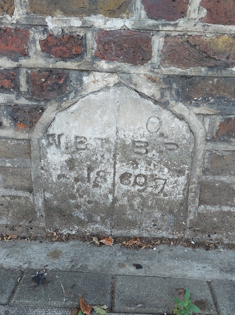
I wonder what it means?

Between the two sets of gates, Boston Manor House itself hid behind the high wall.

Peek-a-boo!

Meanwhile, the other side of Boston Manor Road was lined by a continuation of more Victorian-looking terraced housing. If you approach the bus stop for The Ride on the E8 or 195 bus, the automatic voice announces “The Ride” bus stop for you, in rich plummy tones, perhaps because it was once called Colonels Drive and is home to Gunnersbury Catholic School. Clitherow Road is a turning off The Ride, not to be confused with Clitherow Avenue not too far away up in Hanwell, both a nod I guess to the Clitherow family who owned the Boston Manor estate for 250 years until the 1920s. It’s also where we turn off on our way to Brentford home games, intoning “The Ride” as we do so.

From here to Manor Vale bus stop the residential facades opened out from terraced to a more semi-detached aspect.

The top of Manor Vale.

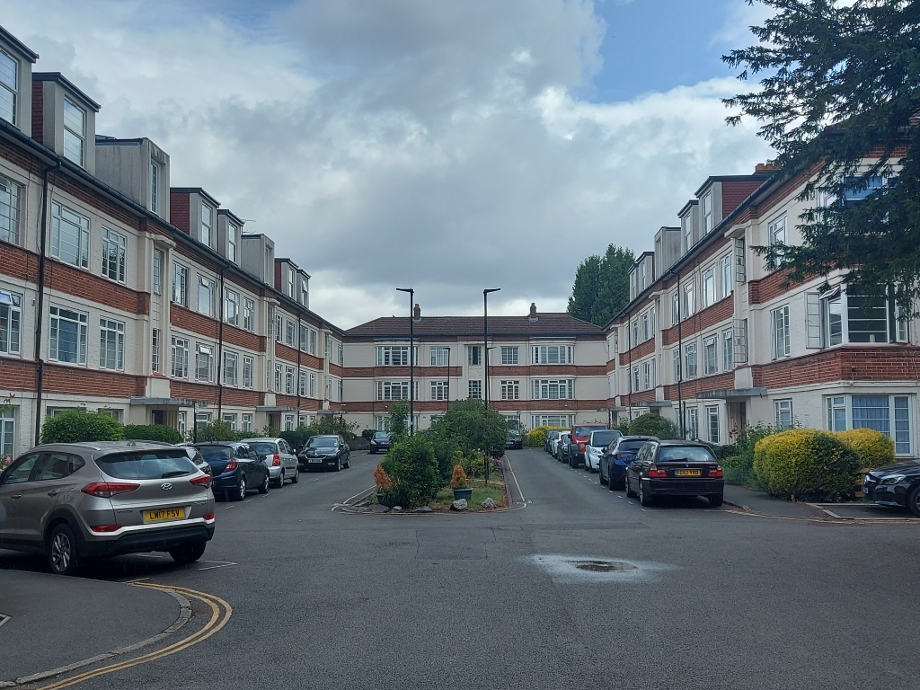
At the top of Manor Vale, I turned into a gentle dip of a side road and an intriguing step back in time. Mature trees and hedges of laurel, holly and privet preserve the privacy and dignity of these once swish three-storey art deco blocks. Now mild mannered tatty, untouched yet maintained, they were probably once home to the yuppies of 100 years ago. I wonder who lives there now.

The bottom of Manor Vale.

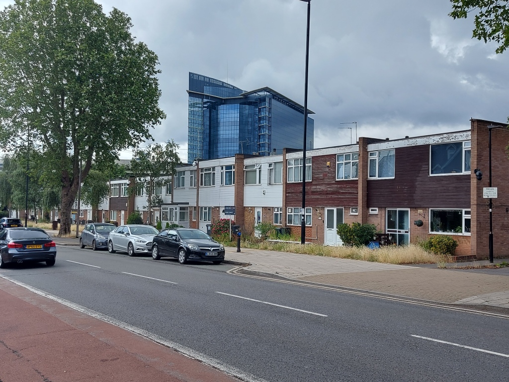
At this point I felt myself being drawn nearer to the Great West Road and the cars flying across the elevated section of motorway that bisects the University of West London skyscraper and the distinctive mirrored glass and steel of the GSK edifice. Like an Asian city skyline in miniature.

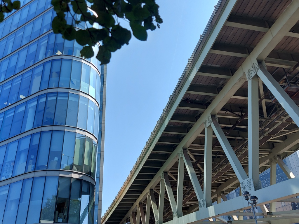
UWL tower and the flyover.

The flyover under construction.

But before that there were still many side road side shows to visit, that I’d been past on the bus, but never down. It gave a new perspective on the familiar.
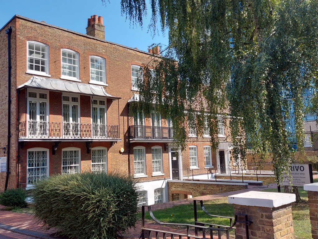
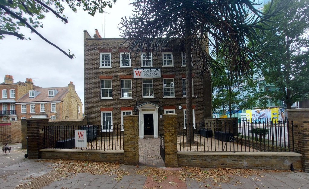
Boston House.

Georgian buildings cluster here, hiding low car parks: Clitherow Court, Boston House and Prospect House. Some are flats, others are neat office conversions.

Prospect House.

Meanwhile, on the other side of the road, was a row of 60s/70s square houses; terraced boxes recessed into the long wall where it ends at the bottom section of Boston Manor Park. They were in varying degrees of repair but interestingly each one was different.

Box houses with GSK building behind.

As you drift under the flyover you can feel the pull of the new. The sea-green steel girders carrying the elevated section of the M4. The wedge of the Co-op shop next door to the UWL tower and The Mille office rental in the concrete tangle gloom. On the right is the tall glass and bright steel of the GSK building above the trees.

Boston Manor Road also continues on the other side of the Great West Road.

My passegiata complete, I turned around and squinted back up Boston Manor Road, thinking again of how it all looked 120 years ago. Indeed, aside from the manor house and its estate, from where I stood all the way up to the tube station was once a couple of farms, some fields and woods, and a muddy lane.

Houses started lining the Boston Road (as it was then called, and Boston Lane before that) from the mid-19th century after the arrival of the Great Western Railway. Trams rattled up and down the road. Another railway, the Midland District Railway followed the northern edge of the manor’s grounds and in 1880 Boston Road station was built, opening up the southern part of Hanwell to development. The station was renamed Boston Manor in 1911.

*With acknowledgements to Hanwell & Southall Through Time by Paul Howard Lang

If you’d like to find out more about Hanwell, local historian David Blackwell has a fascinating collection of books, maps and photos, old and new, of Hanwell and neighbouring areas. They are on display at Hanwell Library on the first Saturday of each month from 10am to 3pm. On the third Saturday of each month the display is more about Ealing in general.

A Hanwell walk 6 – down Boston Road to the tube station

William picked up his bundle of tools and left the new manor house at Sudhale. He trudged eastward along the Oxford Road, barely noticing the woods and common on either side, for his back ached terribly after a hard day’s wood carving. Approaching Hanewelle, he splashed through the shallow river, wishing the lord of the manor would repair the collapsed bridge. Then up the lonely hill to the corner of the path to Brentford. On this corner stood a huddle of small cottages. Some called this corner Tickill, William called it home…

The view from under the clock tower

Stand by the clock tower and reflect that this part of Hanwell was called Tickill on a map of 1680. Tickill Clock Tower. Has a certain ring to it. This is one of the busiest spots in Hanwell – the junction where Boston Road meets the Uxbridge Road. These days, shops and cafés are packed together here in busy density.

Fade To Black has now faded completely

Boston Road is a one-way street. On the left-hand side, looking south, all is a hot spot of bustle and confusion. Until recently, in the now closed Fade To Black corner café, locals chatted and cappuccino steamed under the mini minaret. If you turned the corner too fast on leaving you risked colliding into the kid riding a bright red pedal car outside the Expresso kebab shop, for want of anywhere else to play. Or being jostled by those struggling to catch an E8 or 195 at Jessamine Road bus stop.

Fade to Black has re-opened, as Momentum. So you can get your fix of top-notch coffee once again, while perhaps catching up with the movement hoping to transform Labour…

Exploring the little yard just after the bus stop takes seconds – a cosy motor repair shop. Next up, Jessamine Road is dead-ended by the high brick wall of Lidl – its aspect less cosy. Maunder Road is a narrow meander; it looks dead-end, but isn’t.

Have you ever visit bitchers?

Things are busy on the right-hand side, too, but the vibe is a bit calmer, the pavement wider. Mleczko on the corner and its endearing sign (Have you ever visit butchers downstairs?) used to be a branch of J Sainsbury 100 years ago. Big Bites is back. Hanwell Kebabs is still the best!

When it was Sainsbury’s

On this first stretch of the walk, these shops and businesses, and the flats above them, are a mix of mid-20th century and Victorian/Edwardian terraced buildings. They are now punctuated by the latest wave of new buildings, inspired by Crossrail, which will enable travel to and directly through London.

Please don’t rain on my parade

The vibe isn’t always calmer on this side though, you sometimes find an individual looking anxiously up at the flats above the parade of shops – sometimes shouting. First thing you learn is that you always gotta wait. There are some interesting little side-streets to slip down when the waiting’s over; the nearest being Wilmot Place. The disused phone box opposite is alos popular in this regard.

A good mix of the usual suspects can be found on this part of Boston Road: kebab shops and cafés, newsagents, hairdressers, dry cleaners, a florist and solicitors. But there are some eclectic and unusual premises, too: security and electronics businesses, a posh flooring shop and the Olive Orchard Boutique. Another shop has closed down since I last walked by a few days ago. All signage has been removed and already I can’t remember what kind of shop it used to be.

Golden & Wonder

Next up, Seasons Close is gated housing, the entrance flanked by the Golden Chip fish and chip shop on one side and the Little Wonder bakery on the other. Both are run by the same family and both are marvellous. Good quality and friendly staff.

Ghost sign

Londis near the bottom of this stretch used to be Costcutter. What it was before that, I don’t know, but the brand was originally known as London & District Stores. Lovely name. Ghost signs on the wall, above the buddeleia next to the wonderful Provender Mews, offer fading reminders of how things used to be, and how they change over time.

Mews, mews! Read all about it!

Next door is an arch leading to a lovely mews – Queen’s Terrace Cottages. Further down we have George Bone Tattoos, accountants, solicitors, the Dodo micropub, and a café-cum-florists called W7 Emporium.

Tattoo You
Cottages opposite Provender Mews, with Hanwell Square in the background
Hanwell Square, oh yeah!

Hanwell Square is a massive new residential development on the site of the old Wickes. The building looks like it’s nearly finished and residents will soon be moving in. High-earning young professionals will spend their golden handshakes on rooftop sundowners while enjoying the bullet point benefits of state-of-the-art apartments, shops and cafés, landscaped courtyard, charming locals and prime access to Crossrail/Heathrow/M4. They probably won’t worry about possible new-build scope creep tactics… This might be the third main wave of building expansion over the centuries, but this time it’s on land previously built on.

Prince of Wales aka The Pig
The Village Inn

Perhaps the new residents will try out the two old-boy pubs nearby on the fork of Boston Road and Lower Boston Road: the Prince of Wales (which used to be the Pig) and the Village Inn (which used to be the Royal Victoria). They won’t know about the wonderful Horseshoe Café that used to be next door, now a crammed in new build/conversion. Maybe they’ll hang out at Ben Scooters, everyone else seems to.

Ben Scooters. Usually busier than the adjacent pubs

They will likely enjoy the Hanwell Hootie, which takes place every year in pubs and other venues all over Hanwell, and especially here on Boston and Lower Boston Roads.

A map of 1786 shows Boston Road as a lane to Brentford with very few buildings (Park Farm perhaps, which was occupied as early as the 13th century). By 1816, there were a few cottages at the junction with Lower Boston Road, and by now all remaining land to the north of Park Farm had been enclosed.

The catalyst for the first main wave of building expansion in Hanwell was the development of rail travel, when the Great Western Railway opened in 1838, crossing the Brent valley on Wharncliffe Viaduct. In the 1870s and 1880s, large-scale building began and by 1894 the area between the railway and Studley Grange Road was dense housing and not a lot else.

This area is known (especially by estate agents) as Olde Hanwell and also extends up the Lower Boston Road and down to the Fox, where the River Brent meets the Grand Union Canal. The whole length of Boston Road, by now two-way, is generally flat, though most of the side streets on the right slope gently down to the canal.

Nissan Westway no more

On Boston Road itself, Nissan Westway is making way for yet more third-wave residential new builds – the young lad in me used to like seeing the big car transporters. Next on the left is the ambulance station; handy for Ealing Hospital. After that an Access self storage place. For some reason I really like these, even though the hedge in front of this one reeks heavily of fox.

Can you see Osterley Park from here? I can’t

Meanwhile, on the right-hand side as you continue south, you pass the tops of Rosebank Road, Osterley Park View Road (which has a view, but not of Osterley Park as far as I can tell) and Studley Grange Road. Late 19th century terraced houses, I’d say. These side roads are narrow, or maybe the cars these days are wide – in places they nudge up onto the pavement. Until about 20 years ago this area was dotted with small factories. A map of 1865, 27 years after the railway arrived, shows Boston Road built-up as far down as here, with gravel pits and Park Farm further down. By 1920, there were allotments in between the gravel pits.

The Red Lion

Back on the other side of the road, Tools4Trade used to be the Red Lion pub, and a tricky little mini roundabout by the junction of Cambridge Road, leads to the Royal Mail Sorting Office and one of Hanwell’s dismantled but still operational LTNs.

It’s a mystery, oh it’s a mystery

Then the shop on the corner that still (I think) occasionally distributes groceries to those who can’t afford regular shops, and used to be an antiques shop called Studio something. A few doors down, Iverson’s Tyres/MOTs is now Halfords.

I like driving in my car

At this point, moving south away from Hanwell Broadway, the architecture of the houses changes from Victorian/Edwardian to a more modern style. For in the 1930s, the second main wave of building expansion started with Humes Avenue and continued all the way down the Boston Road. Indeed, most of the south of Hanwell was covered with streets and houses by 1932. Humes Avenue is home to the wonderful Humes Avenue Garage that does a great job and doesn’t rip you off. The area bounded by Studley Grange Road, Boston Road and Townholm Crescent was once gravel pits, all the way down to the canal. Indeed, Humes Avenue is named after Thomas Hume, physician to the Duke of Wellington during the Napoleonic Wars. He later lived nearby and built a wharf to load gravel onto barges bound for London. 

South Hanwell Baptist Church…
… and the scout hut next door

At the top of Humes Avenue is South Hanwell Baptist Church and the wooden scout hut of a church hall adjacent. Then a tile shop with a tatty flat atop – the shop was once a petrol station. Behind these is an estate of flats – Lambourne Close.

The tatty top tile shop…
…that used to be a filling station
Trumpers Way

We pass the top of the delightful Trumpers Way. Not always easy as we dodge the frequent sudden appearance of Getir scooters trying to get-there. As we hope to as well in a future post. Well worth exploring.

Looking back at the Boston Hotel

Then Boston Hotel used to include an Indian restaurant that’s now Kone Japanese restaurant. We’ve been in once and have also ordered a good few takeaways – highly recommended. A few more shops, a multi-cuisine takeaway and a couple of hairdressers. Opposite, across the zebra crossing you have a shop, another hairdressers and a petrol station that’s handy for the late-for-workers and the live fast/die young brigade, who find it impossible to observe the 20mph speed limit. I guess we all do at times.

More thirties semis on the right, including Townholm Crescent which, like Humes Avenue have the solid look of old council houses and are set on wider roads than Olde Hanwell. Just don’t let anyone hear you call it Molde Hanwell.

Halfway houses, their denizens and a paint shop haunt the left before the turning into Oaklands Road. In 1886, the remains of sixth century Saxon warriors were found on the site of what is now Oaklands Primary School. After the turning is Hanwell House, a residential care home next to the Cumberland Road bus stop.

In the 19th century a glacial erratic, or Sarsen stone, was found in the area of what is now Townholm Crescent, in a place where you wouldn’t normally expect to find a large flat boulder about five feet long. It was deposited at the end of the last Ice Age as the ice melted and retreated. There it stayed until house-building started on Townholm Crescent, when it was moved by builders. It now resides just by the main gates of Elthorne Park.

The glacial erratic

To think that 12,000 years ago this area was all covered by a thick sheet of ice. In more modern times it was all heathland, then farmland. Until a couple of hundred years ago, Boston Road was a lonely lane connecting Brentford to Hanwell. There were very few buildings of any sort.

One of the more informative park signs

Elthorne Park was opened in 1910. It has a bandstand, joggers and dog walkers, and people who do Tai Chi in the early morning. The Hanwell Carnival float parade ends here, and the many participants and onlookers wander among the stalls and rides, no doubt waiting to see which pooch would steal the dog show. And talking of winners, the school next door was attended by Lioness Chloe Kelly.

According to Eric Leach, the first known evidence of human occupation in Hanwell is Paleaolithic flints discovered in gravel pits opposite Elthorne Avenue in 1910. This means the first Hanwellites settled here any time between about 500,000 years ago and about 11,000 years ago.

Church hall with church to the left

Nearby, St Thomas church hall sometimes shows films. The front porch sags in the middle. Or maybe it’s meant to look like that. The church next door is imposing, but I can never decide if it’s handsome, too. It does have a flagpole, and a flag of St George (usually).

The house on the corner must be proud of its collection of street furniture

At this point on the walk south, the almost-semis start getting larger, and more spaced out on both sides of the now-tree-lined road. Few of them have front lawns, most are paved.

The Royal Harvester. No silver service, but it’s OK you know

Otherwise, there’s not much to distract, on a stretch that always goes on further than you expect it to. Until you get to the Royal, that is. The Royal Harvester is one of our locals and used to be called the Royal Hotel.

The Royal Hotel. I’d guess in the mid-1930s?

Back in the day, it had a restaurant offering silver service. Nowadays, it’s Harvester Fayre, including a cheeky little mac’n’cheese.

What a sweet offy it must’ve been

The old off licence behind the Royal is now a plant and flower shop.

The top of the lane

Opposite is the grassy southern entrance to Elthorne Park leading to the top of the wooded lane that goes down to the canal.

At the Copa, Copa Cabana…

Back on the left, we have the Royal pub garden (squint and pretend you’re on your holidays).

Maybe 60s, or maybe 70s?

Then, some 60s/70s maisonettes…

On the hit parade

and last but not least, a shopping parade of miscellany a bit further down, including the lovely Nepal, Sainsbury’s, a café-cum-post office, a coffee shop, takeaways and the inevitable hairdressers. Somewhere near here, as if anticipating the tube station, the road name changes from Boston Road to Boston Manor Road. I don’t know exactly where, nor why.

Boston Manor Service Station scene

Across the road, you have a car repair station that has an art deco feel to it. A little further down, opposite the tube station, there’s a small office block. 1970s I’d guess. It’s called Boundary House and is home to a branch of Airivo serviced offices – your space your way.

Bet there’s a great view of the railway tracks from the top

And if you peep round the back, you get a wonderful view of the back end of Northfields Underground Depot with its massed ranks of trains parallel to the Piccadilly Line. From the top of the office block you could imagine a sort of steel bouquet: the train tracks behind the fence as flower stalks and the row of train fronts as red-bottomed flower heads.

Steel bouquet

Boston Manor station is a portal to escape – the Piccadilly line runs south west from central London down to Heathrow. It was first opened in 1883 as Boston Road station.

Boston Road station

The current station building opened in 1934, coinciding with the second wave of building expansion. It was designed by Charles Holden, and is more eye-catching than most of the work he did for London Transport. You may know the pub by Collier’s Wood tube station that’s named after him.

Boston Manor station

The station front semi-circular concession still features the Cup of Joe Coffee Shop signage, but the shop itself is long closed. A forlorn hand-written note in the window says ‘face masks for sale inside’.

I’d read about the Hanwell Gospel Oak that was supposed to be near here, and a couple of years ago spent a lockdown exercise hour in search of it. It’s just as well social distancing prevented me asking anyone for directions. It turns out said oak lay beside the road just to the north of where the tube station is now until around 1928. Instead, we now have what I call the nettle pit, a gap down the side of the tube station, also just to the north. For most of the year, it’s full of what must be very tall nettles. Perhaps in years gone by the local magistrate might have punished minor transgressions by ordering the miscreant to be ‘Cast into the Nettle Pit!’

So the walk packs more in than you might have thought, for such a short stretch of average suburban London street. All compressed in time when you consider millions of years ago when it was molten rock, then sea, swamp and glacier, and more recently woodland, heath and river. And now it’s on its way to becoming beige, a clean brushed-brick Crossrail new-build beige.

If you’d like to find out more about Hanwell, local historian David Blackwell has a fascinating collection of books, maps and photos, old and new, of Hanwell and neighbouring areas. They are on display at Hanwell Library on the first Saturday of each month from 10am to 3pm. On the third Saturday of each month the display is more about Ealing in general.

You might be interested in these other blog posts about Hanwell…

Walk out to winter (on parallel paths)

Hanwell during lockdown

LTN boxes and bollards

Introduction of LTNs during lockdown

Hanwell Square! Oh yeah!

The new development

From heaven’s gate to prison gate

A walk down High Lane, Hanwell

Hanwell’s rubbish

Litter and fly-tipping

Hanwell Hootie – what a beauty!

The local music festival

Brunel in Hanwell – Wharncliffe Viaduct

A special place

A Hanwell walk – 1

From Hanwell Broadway to West Ealing

A Hanwell walk – 2

More of a West Ealing walk, really