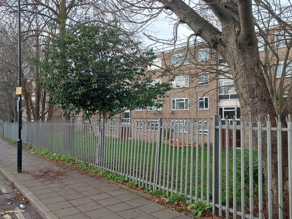
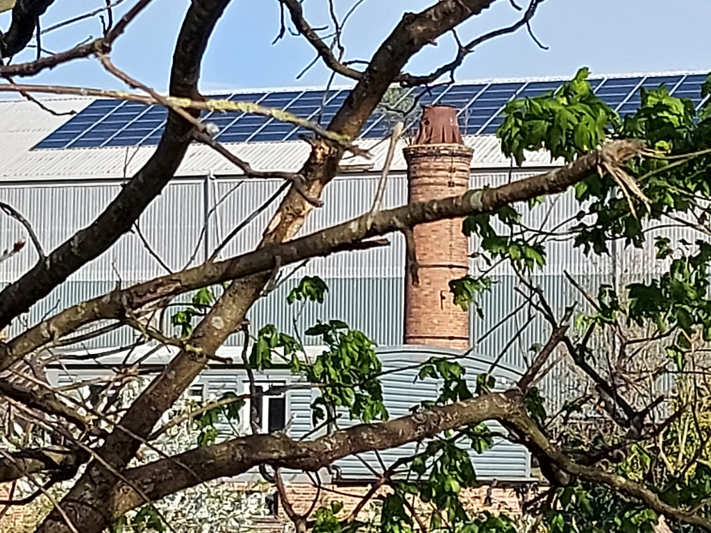
The Living Chimney peeps up from behind the trees at the bottom of Humes Avenue and it feels like a bit of old red-brick northern England industrial has been transported to South Hanwell. It was the first thing I noticed when I moved here many years ago, for it stands tall and handsome among the warehouses and old workshops on the other side of the canal. It lives because it has bushes growing out of and around the top. Intriguing.

The Living Chimney from the bottom of Humes Avenue
The best way to get to the Living Chimney is down Trumpers Way, a lovely name for a street as well as being something of a place oddity.

The streets of Hanwell are mostly residential or retail, but Trumpers Way is more back entrance back residential. There are no house fronts and no shops.

Despite the apparent lack of a destination, there is plenty of traffic, mostly vans and lorries, and a steady stream of Getir scooter riders turning into Trumpers Way in a frantic rush to Get there, or Get somewhere… wherever that is.

At the top of the road looking down from the Boston Road, you have the back entrance/car park for the Boston Manor Hotel on the left, with a welcoming sign that accommodates the hospitality trade’s favourite spelling mistake. As you carry on down past high hedges and tidy fences you can work out that behind them stretch the long back gardens of Townholm Crescent. True Bill and Ben the Flowerpot Men territory.

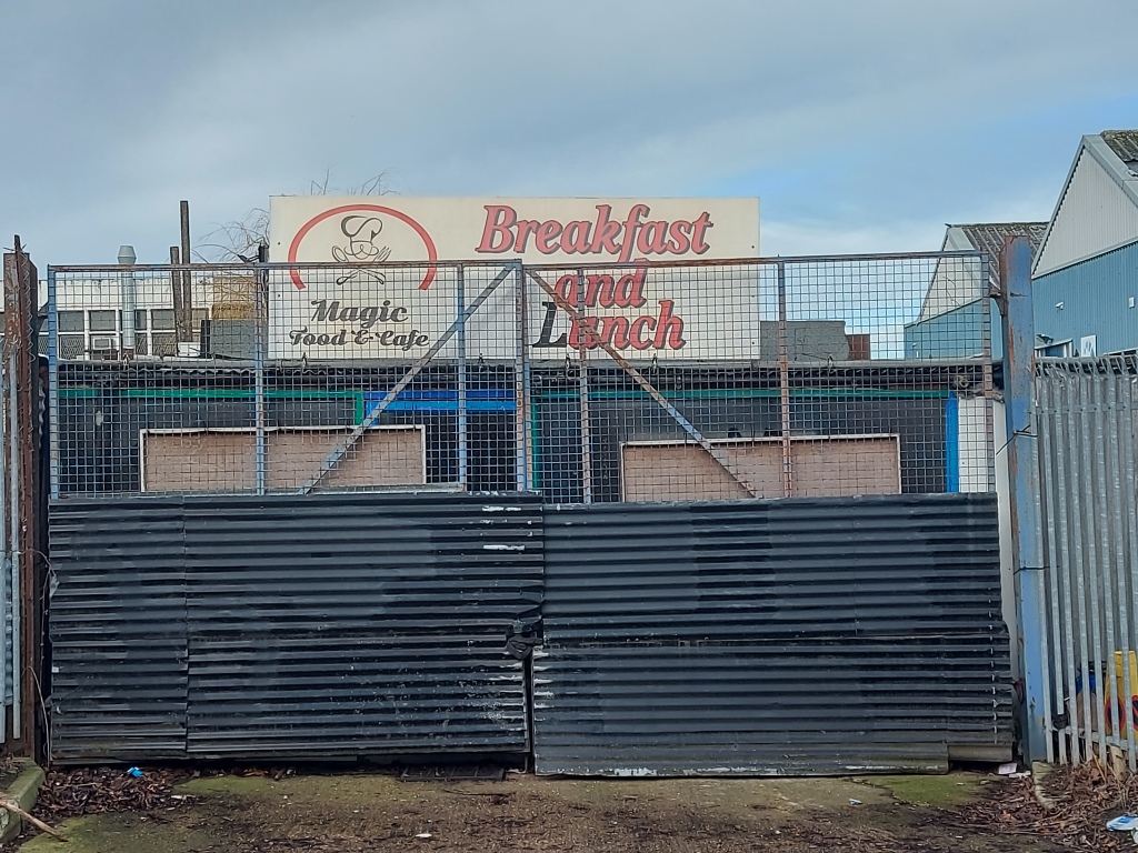
Back at the top of the road, this time on the right-hand side, is the tatty charm of the tile showroom and the flat above it.

The building used to be a petrol station and still retains its convenient hard standing parking spots.

Next up is Lambourn Close – blocks of flats behind trees and fences. They remind me of student accommodation. Again, near Trumpers, but not really on it.
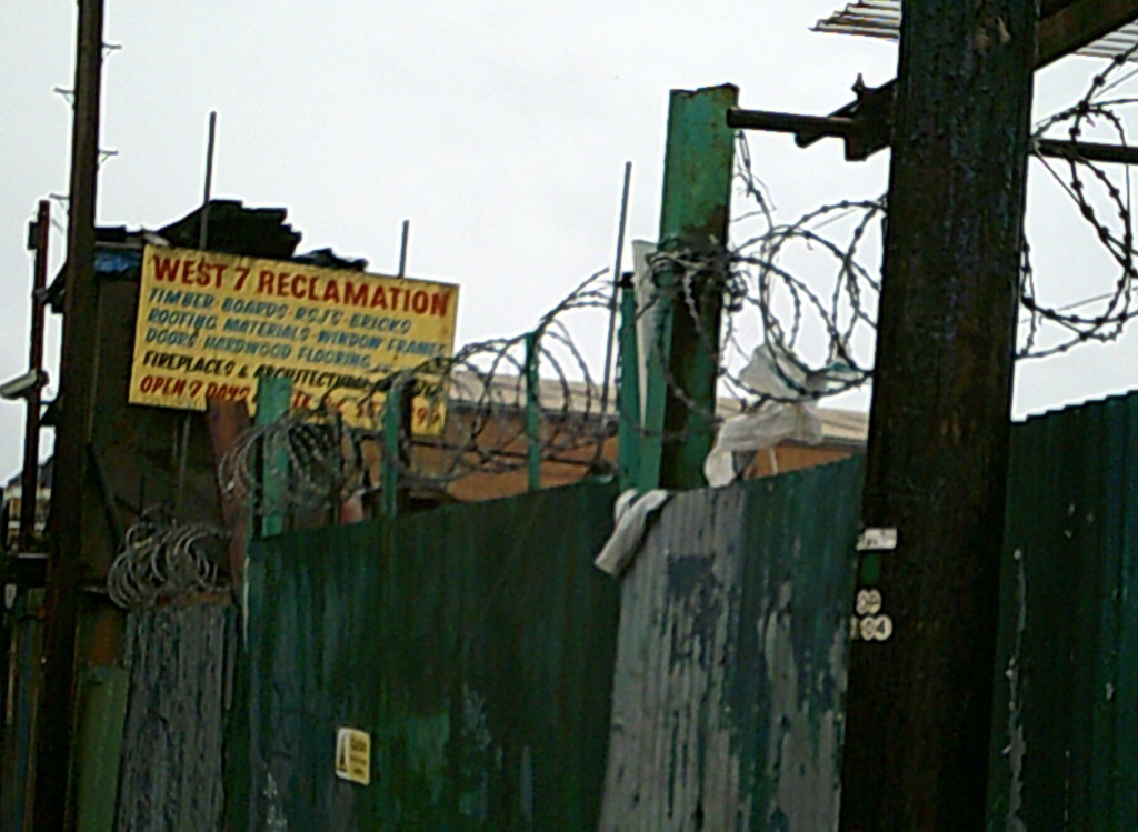
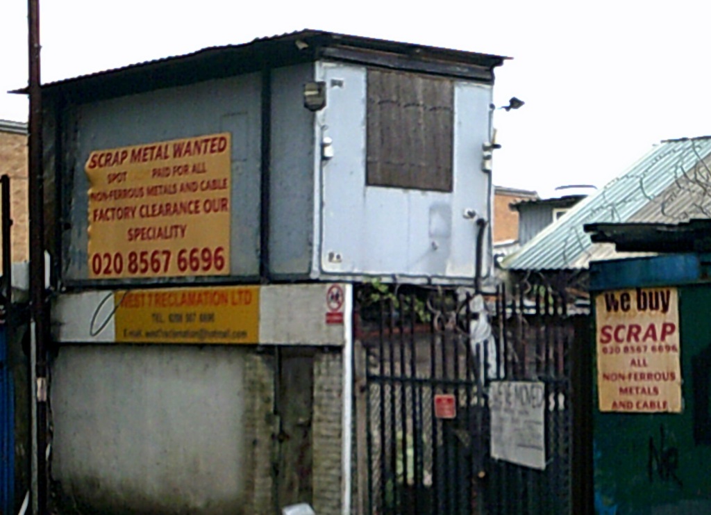
After that on the right is a stretch of green wooden hoarding hiding a building site.

This used to be a fascinating collection of scrap metal and motor repair businesses, all barbed wire and corrugated iron and terrapins. All gone now.

Word is the new buildings will be mixed residential, a development called Elthorne Village. The proposal is for more than 200 new homes to be built on just under two acres.
Meanwhile, on the left, articulated lorries rest up in the shade of a clump of trees behind which lie the wide open spaces of Elthorne Park.
The road has the feel of being an old route, but is it? As far as I can tell, it appears on a map of 1894 as a track turning off from Boston Road between a short row of cottages and a gravel pit. As with many pits across the area, the latter was found to contain many flint chippings from paleolithic toolmaking, and occasionally entire implements. I could be wrong but a map dated 1800 seems to show a track leading along the bottom of Hanwell Heath and the top of Park Farm from Boston Lane to the River Brent. This would have been before sections of the river were straightened and incorporated into the canal, and the various associated activities of gravel extraction and brickmaking in the 19th century, as well as the mass transportation of goods from points north to London, before the railways were built.
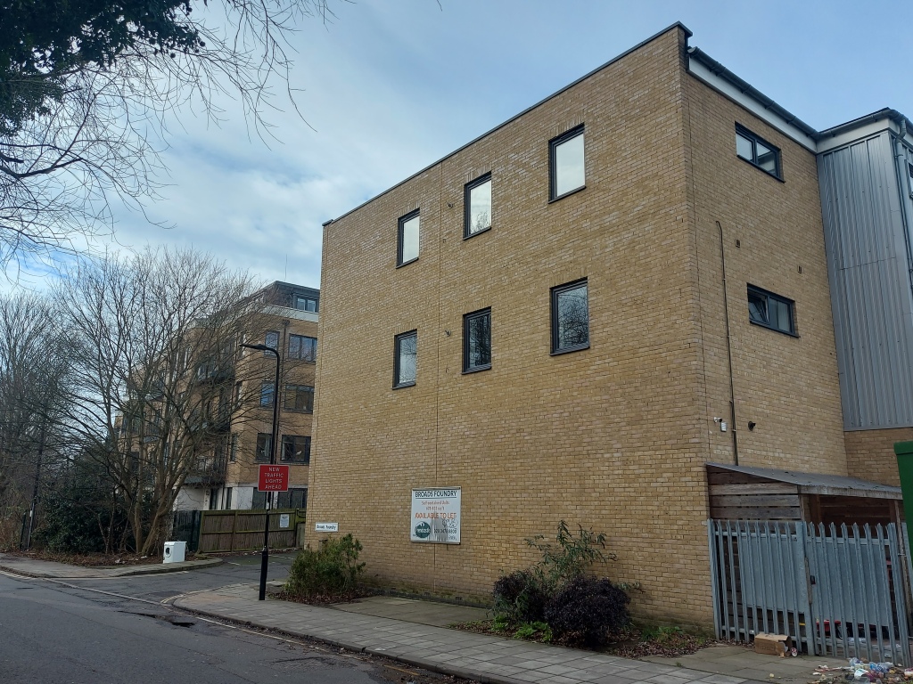

On the right is Broads Foundry, a large old edifice where manhole covers (or maintenance hole covers as they are now often called) used to be made. The building has now been converted into I’m not quite sure what. Flats? Business units?

We received a leaflet through the door recently, canvassing for opinions on a new Scout and Community Hall to replace the current one. And sure enough, the sign outside the hut confirms this.

Brings to mind jumble sales, bob-a-job week and the smell of bonfires. I’ve heard that sea cadets were also once based round here somewhere, splashing around learning boatcraft in the canal.

As you approach the canal you pass a kissing gate into Elthorne Park, then cross over the canal bridge itself, on the side of which the charming “Hanwell boot boys kick to kill” was once painted.

From one side of the bridge you can watch boats, water birds and the quaintness of the units around the Living Chimney.
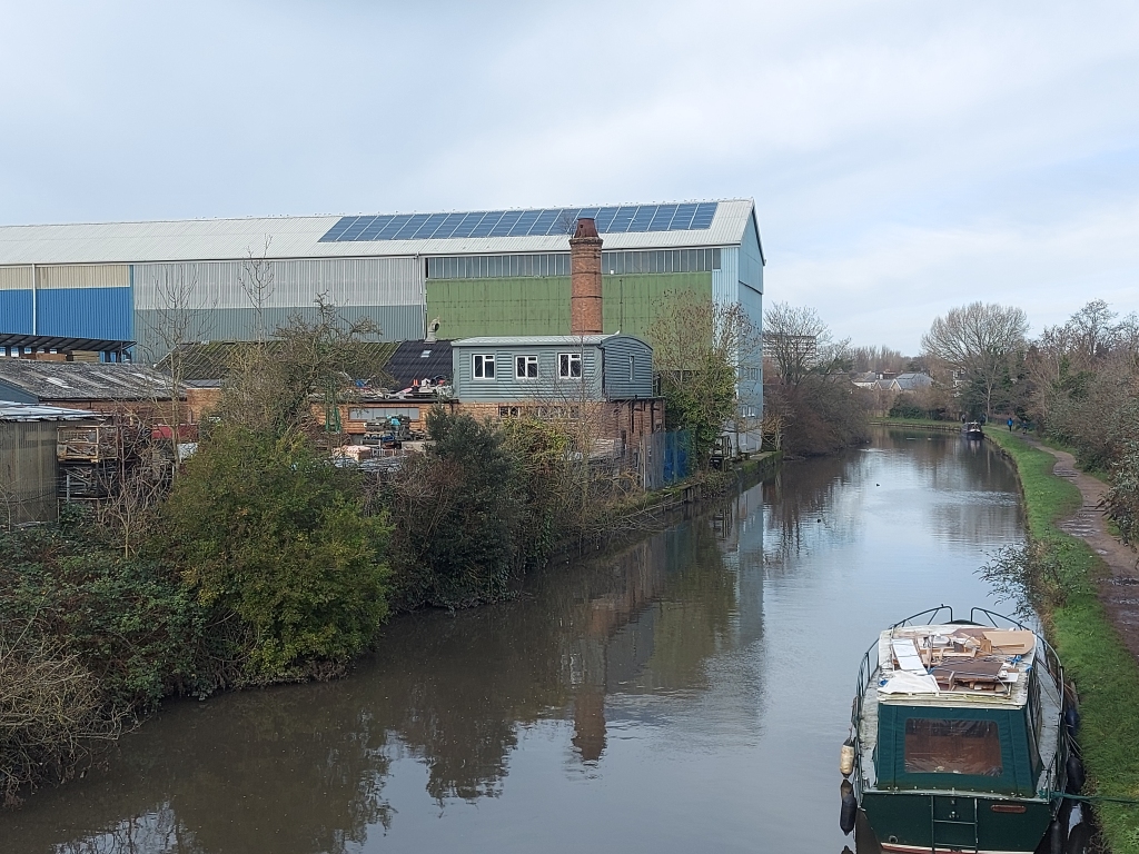
From the other, more imposing buildings of industry like Patterson.

Once over the bridge you are literally at the business end of Trumpers Way. If you look at a map or even go for a wander around, as I did, you’ll see there’s quite a bit to it.
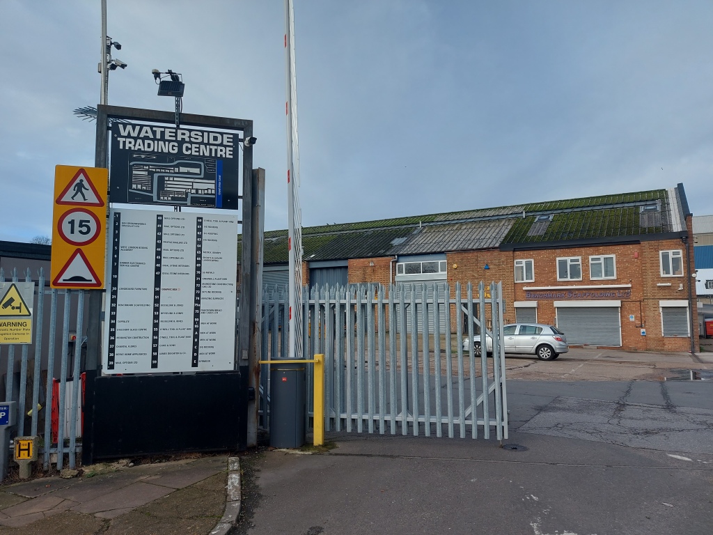


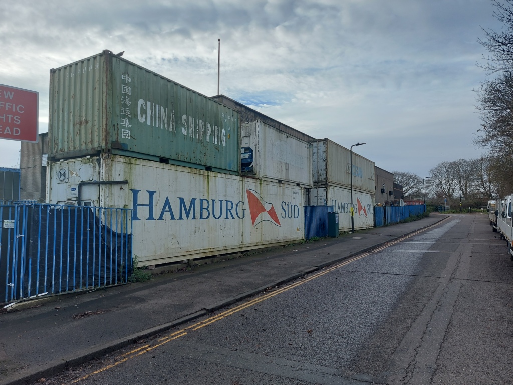
Waterside Trading Centre on your right contains a lot of small business workshop units: bespoke furniture and work top manufacturers, mailing houses and the like. A larger unit stores scaffolding/girders, where two workers threw suspicious looks at the stranger taking photos. A hi-vis security guy occasionally strolled outside his security booth to keep an eye on me and probably anyone else he didn’t recognise. I wandered past the West London Boxing Academy towards… the Living Chimney. Most of the buildings look to be from the 1960s, though the Living Chimney looks older, Victorian even.
There’s a burger van/kiosk that I’ve barely noticed up till now when on my way to Warren Farm. On closer inspection it’s a proper caff; quite a nice one, as it happens.


Opposite the Waterside Trading Centre is Canalside, home to Patterson Construction, Kiwi Building Services, Kiwi Landscapes and Kenways Furniture. And there’s a lovely old Roller in the car park.


Further down Trumpers Way, round the corner on the left, is Boston Business Park. It’s more modern than Waterside and the units are bigger.


There’s some interesting old brick work at the back by the freight-only railway line. The remains of an old bridge, perhaps?

And from the other side of the railway, you get a different view.
In the opposite direction, a path leads alongside the railway around the outside of the Waterside Trading Centre, to the far corner where you can find various roadway signs for diversions and the like, neatly stored for any eventuality.
What was this area like many years ago? It’s hard to conceive how things were before the river was straightened to form part of the canal. In the 20th century there was a council tip here where they burnt rubbish. There was also Gillis’s pig farm and some allotments. Piggeries Orchard is still shown on the map between the canal and the bottom of Studley Grange Road? Was there a connection?
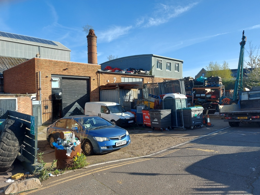
According to a conversation I read on Facebook, the Living Chimney used to be part of corrugated cardboard mill. Enormous reels of paper were brought here originally by barge, later by lorry, and stored in the adjacent large warehouse structure. They were used to produce corrugated fibreboard sheets that were then made into packaging. The corrugations were formed using steam generated by oil-fired boilers and the heat was expended by the Living Chimney. By all accounts it was very hard work. The mill closed during the 1980s.
On my way home I decided to drop down to the canal for a different perspective.

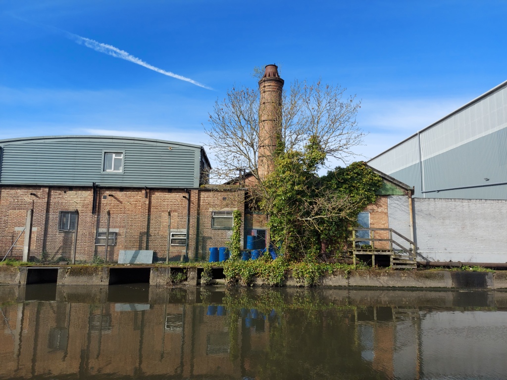
I’m glad I did, for I also got to see a pair of swans on their nest, just under the Living Chimney.


If you’d like to find out more about Hanwell, local historian David Blackwell hosts an exhibition about Hanwell on the first Saturday of each month. Exhibitions about the Borough of Ealing are held on the third Saturday of the month. Both are at Hanwell Library 10am to 3pm. Entrance is free and there’s no need to book.

You must be logged in to post a comment.